While visiting my wife at her workplace down in Templeton, in California’s Central Coast region, I took some time to do some hiking. First stop was the Los Osos Oaks State Preserve, which might actually be in Morro Bay rather than Los Osos. It’s pretty close, I think. Quite accessible from the Templeton/Paso Robles/Atascadero area – maybe 30 minutes if you average all three starting points.
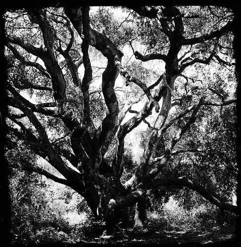
I read about the preserve in the Sierra Club’s Trail Guide for San Luis Obispo County. I was drawn by the description of these 800 year old “dwarf oaks,” which are HUGE and have branches so long and so heavy that they have touched back down to the ground for support, then grown out from there. 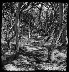 They really are impressive. It’s described as “mystical” in the book and that’s actually not a bad description. I went around noon which made it a bit less so, but I can see a morning hike being quite atmospheric.
The hike is also a level one, and relatively short. Maybe 100 ft in elevation change and about 2 miles, I think, based on the loop I did. I spent about 2.5 hours there (note: I’m a slow hiker due to stopping constantly for photos).
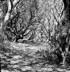
I enjoyed the preserve, and would go back with a wider lens to get more of these giant trees in frame. But…and this is a big one…the trails are basically unmarked except for when they start. There are markers when they intersect, but there are dozens and dozens of well-worn, very visible trails that shoot off all over the place. It’s hard to tell if one is even on a trail. So having posts at intersections doesn’t help if you’re not even on the trail anymore.
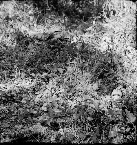
At one point, I was literally in the middle of a grove of trees, walking along what I thought was a poorly maintained section of a well-marked trail, before I realized I was actually just walking through the forest itself. No trail. Nothing formal. Just walking through the woods.
At another, while I was walking back, I found myself back at the road but definitely not at the parking lot. I was next to the creek, which I knew was several hundred feet east of the entrance. Clearly I had missed something. I walked about .5 miles back to the last intersection of formal trails to verify I had headed the right way. Indeed I had, so I went back again. A little ways before I got to what I knew was the wrong ending point, I took a second look at this indentation in the shrubs and grass to the left, with the stump of a fallen tree visible about 10′ away. It looked nothing like a trail, but I knew I had to go that way, so I pushed my way through the grass (through, not between) and walked right at the tree trunk and…lo and behold, there was a clearly marked trail on the other side.
That’s how I found my way back to my car.
Not sure I’d visit again…