kaiyen: pepper

the life and times of Allan Chen

Latest Posts

China turns the tables…and still controls the future of the world

Op-Ed Columnist – Can I Clean Your Clock? – NYTimes.com

I think this is just a really good op-ed piece.  First, it’s about the power that China wields when its government decides to go one way or the other.  Second, it’s actually kind of scary, in a good way, that China realizes the importance of being climate-aware and investing in green technology and research.  It’s also just plain scary since it maybe means one more thing that we’ll rely on the Chinese for (we already owe them trillions). 

Oregon Coast Day 3: Bandon

We stayed another night at the Sunset Motel in Bandon.  There is simply so much to do in the area.  The original plan was to spend day 2 in Bandon heading north, perhaps as far as Shore Acres but probably not quite to Coos Bay.  However, we really wanted to keep things flexible and just see how things went.
Coquille Light

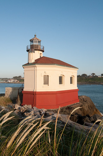
Our second day in Bandon, and third overall on the trip involved sleeping in a little bit, and staying in the overall area around the town.  The Coquille River runs right up along “Old Town” and across from the fish and chip shacks is Coquille Light.   This short, interestingly-shaped structure is in Bullard State Park, which also offers some nice dunes and what seems like all of the driftwood in the entire Pacific Northwest.  The funny thing is that when one drives to Old Town Bandon the lighthouse is right across the river, and seems just a few hundred feet away (and might be less than 1000′).  But to get to it one drives out of town, up 101 for a few miles, into Bullard Park then all the way down to the very end at a blazing 20 miles per hour.  A lot of trouble to get to the other end of the mouth of the river.

On the way back to the hotel, on Beach Loop, one has access to Coquille Point, which offers a great view down the beach and out to sea.  And is also a place where the wind can practically lift you up and throw you out to the waves.  Heading down to the beach from Coquille Point, one has good access to some sea lions bathing in the sun.  If the wind weren’t so vicious I would have made it out a bit farther for closer pictures, but I did manage to find some refuge in the rocks and a decent vantage point.

Bullard Park offers quite a bit, to be honest.  Most of the park is pretty sheltered by the dunes and trees, meaning that one can do some good photography of the foliage and plants without dealing with the wind.  This would be a great place for some infrared photography, actually.

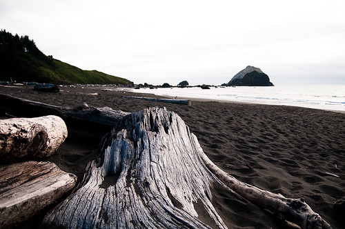
Heading out to the lighthouse, the beach is long but relatively narrow – most beaches seemed to be deep and flat, with big differences between high and low tides.  It’s also just covered with driftwood.  One wonders if somehow this beach catches everything, leaving Bandon Beach free and beautiful.  As you can see from the photo of Coquille Light, there is quite a bit of driftwood out on that outcropping of rock, as well.

sand dune, Bullard State Park

The beach offers very nice options for one wishing to work with dunes, as well.  With all the wind that we experienced on our trip, every 30 minutes or so gave a fresh, almost untouched look to the sand.  The driftwood makes for interesting elements against the sand itself, as well.  Of course, the sand itself against the side light of a setting sun creates very interesting textures and shapes.

Finally, combining the setting sun with the grass, sand, and the lighthouse isn’t a bad idea, either.  It creates a nice composition that I think is pretty subtle yet still gives all the colors that one appreciates from a nice sunset.Coquille Light behind the dunes

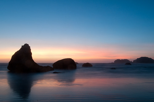
When it comes down to it, though, the sunset on Bandon Beach, with all its stacks, is the highlight of the area.  It’s hard to take a bad shot, even from one’s balcony.  After a few photos around the lighthouse a short but maddeningly slow drive back through the park and over to the motel brought me back down to the beach.  Having gotten a bit more comfortable with the location the previous night, I played around with a bit of long exposure and different elements in the foreground.

The bottom line is that from Brookings to Bandon (and eventually up to Shore Acres) is a truly wonderful area with so much variety.  Next time, I would probably base myself either in Bandon or perhaps in Brookings and just work that entire area for weeks.incoming waves, Bandon Beach
crosswalk


crosswalk

Originally uploaded by kaiyen

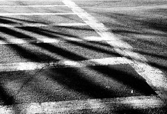
I bring a camera along with me on my “commute.” I use quotes because I walk to work and, while I try to vary things up a bit, I pretty much walk across one major street, then among residential streets the rest of the way. So I try hard looking for interesting lighting, lines, shadows, patterns, and textures. I find myself aiming my lens at the ground a lot, to be honest (not that I don’t get some photos from that).

I apparently am enthralled by crosswalks, as I have an inordinate number of photos of the three that I run into during my walk. This particular image is actually on color slide film, scanned, then converted to black and white. I think that helps bring out the lines even more in the images. Who knows…

Oregon Coast Day 2: Bandon

This is a bit longer of a review so I’ve done a “click for more” separation because we stayed two days in Bandon and I have a lot to say about what we did around there during those days.

Also, I’m separating the days out pretty strictly for these accounts.  For instance, this covers the trip from Brookings to Bandon (day 2), and our next day, still in Bandon (day 3).  I won’t cover the trip from Bandon to Yachats, as that’s part of day 4.  It’s hard to separate the days out as we might have done something on day 3 specifically because of the drive between Bandon and Yachats (that we would not have done had we been driving from Brookings to Yachats, for instance), but I have to cut them up somehow…

Basic facts:

  • Stopped off throughout the Samuel Boardman State Corridor, Cape Blanco, and a couple of other places along the way
  • Stayed at the Sunset Hotel in Bandon, in the Vern Brown Addition
  • Food – see the rest of the post

Stuff I learned on my own:

The Sunset Motel really is worth the effort.  And it’s all about the Vern Brown Addition, stacks at sunset, Bandon Beachfrom which one can literally shoot the sunset from one’s balcony.  The rooms are a bit dated (really just the TV’s, actually) but the views are stunning.  Bandon is tiny as a town, and I’m not sure it’s a “Must Stop” as one guide mentioned.  But the beach itself is really impressive, with some great stacks and smooth waves.  It’s also a quick ride to several different places, so it’s a tremendous base of operations for the whole region.  Yachats as the next location is a good idea since it’s sufficiently far enough away that one can explore the entire Bandon to Coos Bay area.

(more…)

Oregon Coast Day 1: Brookings

Due to driving times, we decided to take the shorter drive first, to Brookings, just over the border into Oregon, and head north along the coast.  Most people and certainly the two books I have seem to head south instead.  But a 7.5 hour drive seemed a lot more manageable than an 11 hour one.

driftwoord

We got to Brookings about 7:30 or so in the evening.  Sunset is very late this time of year – about 9PM, so we were able to check into our motel, get to a decent restaurant, and still “see” the sunset.  I use quotes because clouds completely obscured the actual horizon so we didn’t see the last hour or so of the sun going down.

Our goal was to get to just a basic motel that first night – out goal was to find a place to sleep, not about the view or anything like that.  Turns out that most of the hotels and motels in Brookings are exactly that – functional as last stops on trips down the coast, with few frills.  The exception is the Best Western, where all rooms have a great view, so I hear, but it’s maybe $175 a night.  That’s pretty steep for a Best Western.

We stayed at the Ocean Suites Motel, which turned out to be an excellent choice.  Some of the reviews on TripAdvisor are before the current owners, who actually live on site (when I called to say we’d be checking in late, they even said to just knock on their door if they aren’t at the desk), have made it a lot nicer.  Even so, the reviews are really positive.  Don’t be fooled by the website.  Now, this isn’t the Ritz, or even a Best Western, but it is a suite, with a sofa bed, queen bed in the bedroom, sink, fridge, and quite a bit of space.  It was very nice to be able to unpack the car and just spread out in the room, without having to worry about squeezing this bag into that corner to make sure things weren’t falling everywhere.

We at dinner basically across the street at Smuggler’s Cove.  Not surprisingly, this is a seafood restaurant.  The service wasn’t great and bordered on bad, except that I do believe we were the first in a huge rush that overwhelmed their staff.  That’s not an excuse – I still almost got up and left.  But I could tell what was happening.  The food was pretty solid – my wife and I both had seafood pasta dishes.  She had it with the Cajun sauce and it was fantastic.  They gave me the cream one (I also ordered the Cajun but oh well) which was a bit bland but they give you a lot of seafood.

Not a lot to see in Brookings, but it was a good starting point (and I think would make for a great base for a future trip, based on my experiences on this one).  Glad we went that route at the time, though the drive back at the end – 14 hours from roughly the Tilamook area – was where we paid the price.

cloud bank coming in

What I learned myself that I didn’t from others:

This is the section where I talk about what others told me, and what I learned for myself.  First, Brookings is really just a stopping point.  There isn’t much there, and clearly people don’t treat it as much more than a starting or stopping point for a coast trip.  Second, even if the Best Western has a great view, I can’t imagine it’s worth it.  I’d rather stay in a nicer place and then in a nice hotel with a great view, rather than have a great view in kind of a dead town.  It’s a good place to serve as a base camp at an affordable price for the lower coast.  But that’s it.  And yes, the Ocean Suites is my recommendation, easily.

Infrared Skies by Pescadero


Originally uploaded by kaiyen

The Nikon D50, one of the best digital SLR’s Nikon has produced, in my opinion, was our first DSLR. We got it right before a wonderful Hawaii vacation in January 2005.

When I was ready to upgrade, the D50 was selling for maybe $250 or so. Not really worth it, to be honest. And it wasn’t worth it to keep around as is since I was making a pretty big jump. So I decided to pay $150 to have it converted over to an infrared-only camera. It is only sensitive to the near IR spectrum of light and allows me to shoot handheld. Usually, one gets really long exposure times when doing digital IR.

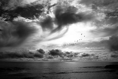
The conversion has produced some really useful applications. One is with skies. The clouds become even more dramatic against an IR darkened sky. Conversion to black and white makes it all the more dramatic, I think. Also, because we have a more sensitive camera in the first place, I can take shots where birds and other moving objects are frozen and still.

It’s actually kind of a funny process, shooting digital IR. IR sensors are inherently overly sensitive to near IR spectrum of light. So manufacturers put a “hot filter” over the sensor, which blocks that part of the spectrum. Those that want to do digital IR then put an IR filter, which blocks most of the visible spectrum, in front of the lens so that only the near IR comes through. This means that a tiny sliver of the spectrum actually hits the sensor. Which means incredibly long exposure times.

In a converted camera, the hot filter is taken away and, in my case, replaced directly with an IR filter. So now it’s just a straight, near-IR-only camera with great sensitivity.

Oregon Coast Road Trip

For the last 5 days and for 3 more, my wife and I have been traveling up the Oregon Coast by car.  It has been our most impromptu vacation ever, by far.  She is a nurse, and managed to work out a long chunk of time between shifts with a bit of creative rescheduling.  But that was just 2.5 weeks or so ago.  Yet here we are (also thanks to a very understanding manager of mine), currently in Depoe Bay, where the sounds of waves crashing against rocks just 40 feet away and 20 feet below lulled me to sleep, and, in conjunction with the rising sun, has given me a peaceful morning.

Hopefully, I’ll be writing a series of reviews on the trip on this blog.  While researching, I found lots of opinions, but all seemed to be missing some details, deviated from books that people mentioned as useful from their own experiences, or were at odds with what the local residents stated.  This confused me.  I believe in getting the opinion of the local inn or hotel keeper about restaurants, etc, and I depend on guide books to help me find the right locations.  And the kindness of others out there to tell me what is really worthwhile during an 8 day trip, as many has does this exact same itinerary in the past.  So maybe I can fill things in a bit.  We’ll see.

The trip started out with a 7 hour drive straight to Brookings, where we essentially just wanted to stay the night but actually had a bit of time to enjoy the sunset.  Then onto 2 nights at Bandon, a night each in Yachats and Depoe Bay, then finishing with 2 in Pacific City.  I’ll start with Brookings in the next post, hopefully to be written tonight.

coordinates and street addresses

I’m heading out on a trip along the Oregon coast very soon and have been trying to make sure my GPS can find all of the hotels we’ve booked.  The problem is that many of them are just addresses along the highway.  That’s probably fine, but I know that, for instance, in Big Sur, there are addresses like “100 Highway 1” that won’t work at all.

Coordinates, however, are supported by my GPS.  But google maps does not convert the indicated address location into coordinates.  Or at least it doesn’t do so in an obvious way.

It turns out that if you select the link option after mapping a place, embedded in that link are the coordinates, though they aren’t formatted correctly and will likely need a bit of testing to make sure they’re right.  Rather frustrating and I think a bad feature to omit, but I guess I should be happy there is a workaround at all.

More google thoughts later…